Tuesday, April 25, 2006
Rain in Augusta
For those of you back home you wanted to see what it was like when it rains here in Augusta. This is a good example of a 'sprinkling' and some of what Georgia has to offer. This however is not a full on rainstorm, because there is not a foot of standing water on the high ground. and yes, I do know my eyes look a little creepy in this video clip.
Reed Creek
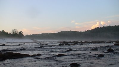
Reed creek actually passes by my house up near the Lakeside Panthers High school, and the trail that modestly follows it near out house is one of the dogs favorite tromping grounds. We have been trying to figure out a way around the various obstacles, so that maybe we could run the creek at high water (regular level is bottom scraping) from our house down to the Augusta Canal where the creek dumps out at this set of low waterfalls : 
The first waterfall is the biggest at roughly an 8 foot tiered drop with the line flowing down river right. This isn't even worth attempting at low water due to the launch and scraping at the top. A quick seal launch can be done from river left above the downed tree. The regular flow pulls hard to the right but there can be enough of a tug to pull you down on top of the tree.
 The next rapid is a lot smaller and the best line also follows the v in the rock on river right. At high water the force of the rapid can easily push a kayaker into the soft sand wall on river right. Due to the structure of the wall it has been eroded in several sections creating small caverns that could easily trap a boat. A few good strokes should put you
  well and clear of this.
This third photo is looking from the top of the last rapid.
Access to this little park and play is very easy.
Directions : Take Evans to Lock Rd. East till it dead ends at the Savannah Rapids Pavillion. After the stop sign take a right into the gravel parking lot and go to the very end. There is the head of a short trail at the edge of the parking lot. Sadly, it is currently marked with a busted up microwave.

You can either follow the short trail to the right and put in off of the 'erosion bank' or you can follow the trail to the left and get on top of the small waterfalls for a look at them yourself.

The first waterfall is the biggest at roughly an 8 foot tiered drop with the line flowing down river right. This isn't even worth attempting at low water due to the launch and scraping at the top. A quick seal launch can be done from river left above the downed tree. The regular flow pulls hard to the right but there can be enough of a tug to pull you down on top of the tree.
 The next rapid is a lot smaller and the best line also follows the v in the rock on river right. At high water the force of the rapid can easily push a kayaker into the soft sand wall on river right. Due to the structure of the wall it has been eroded in several sections creating small caverns that could easily trap a boat. A few good strokes should put you
  well and clear of this.
This third photo is looking from the top of the last rapid.
Access to this little park and play is very easy.
Directions : Take Evans to Lock Rd. East till it dead ends at the Savannah Rapids Pavillion. After the stop sign take a right into the gravel parking lot and go to the very
 end. There is the head of a short trail at the edge of the parking lot. Sadly, it is currently marked with a busted up microwave.
You can either follow the short trail to the right and put in off of the 'erosion bank' or you can follow the trail to the left and get on top of the small waterfalls for a look at them yourself.
Dusk in the hidden garden
There is a secret garden along the banks of the Savannah, and it is truely right  underneath everyones noses and they dont realize it. We descended the hidden stairwell on a beautiful day following several
 underneath everyones noses and they dont realize it. We descended the hidden stairwell on a beautiful day following several
 days worth of rain. Although we were surrounded by trees, the light mist from the spillway saturated our clothing before we reached the river.
What better way to spend a sunset then with friends dangling their feet in the water and perfect weather.
Bartram Trail
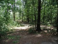
The Bartram Trail extends from Louisiana to North Carolina, and passes through Georgia. Augusta sits smack dab in the middle of a portion of the trail, and thankfully they have restored some of it near the Augusta Canal, and also near the Strom Thurmond Dam.
The hike along the S. Thurmond lake is absolutely beautiful and often times on the weekends I have seen trail joggers/runners and a few mt bikers out there. The trail meanders through the Georgia side of the Dam, on the southern edge of the lake. In several locations you can easily walk down to the lake for a refreshing and secluded dip in the perfect water.

A word of caution, this is also prime hunting grounds for wild turkey and deer, during the hunting season it is imparative that you and your dogs where orange or yellow reflective vests, unless you want a personel Cheney accident to talk about.
Directions :
Take Fury's Ferry (Hwy 28) Into South Carolina. take a left onto Jake Pollard Highway (HWY 221/HWY 150), you will pass over the Dam. About a mile after crossing the Dam look on the right for small parks. Several of these day use parks have access to the Bartram Trail.
Or take Washington Rd ( HWY 47 ) west till you come to Jake Pollard Highway (HWY150) take a left and go roughly 5 miles and look on the left for the same parks.
Tuesday, April 18, 2006
how many do you burn?
Ok, I admit it.. I am not in the best shape of my life, but who is in this day in age in the great society we live in. So, to determine generally how many calories I spend in a day, I fiddled around on a few sites to find out on average how many calories I would burn doing some of my favorite activities.
Here comes the shocker, I am going to say my weight and my estimated BMI/BF!! On average I am about 165, according to the Navy standards I am 31%, although by other calculations I am roughly 26. My BMI is roughly 25, so that means for 60 minutes of mt biking 857, fencing 605, frisbee, general 302, ultimate frisbee 806, kayaking on flat water 504, rock climbing 1109, sky diving 353, Backpacking with a 35-45lb pack 445.5, whitewater rafting 956.
I would say that would give you a fairly decent look into how each event stacks up and also what sort of preperation certain sports take.
If you are interested in finding out what a generalized calculation for your own standards, type in "activity calorie calculator" into your preferred search engine. my searches took at least 3 pages
Monday, April 17, 2006
A Walk in the Woods
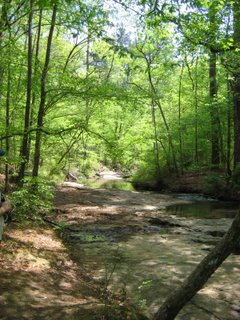
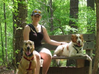 April 16th myself, Tom and the dogs went for a short hike along the trails at Mistletoe State Park. Everytime I go on a hike through these woods it's a completely new expierence, especially now that spring has come and everything is in bloom. We entered a magical world of filtered sunlight and honeysuckle the farther we crept along. The dogs on the other hand, found even more frogs and other creepy crawlies out in the swamps and creeks.
If you look back several posts, you can tell the difference between only a few months.
This was just funny and I thought I should share it.
some of the upcoming events at Mistletoe:
Brain Tanning WorkshopSaturday, Apr 29, 2006 8 AM - 3 PM
Learn firsthand how early Native Americans tanned deer hides to make soft, pliable leather. Bring a lunch and wear old clothing. Call to confirm date. $3 parking. 706-541-0321.
Introduction to Fly FishingSaturday, May 6, 2006 10 AM - 12 PM
Anybody can drop a worm from a pole, but there's a real art to fly fishing! You will learn what you need to get started fly fishing: type of equipment, basic flies and casting techniques. Bring a chair and a fly rod (if you have one.) Register by April 30. $3 parking. 706-541-0321.
Talking TurkeySaturday, May 13, 2006 10 AM - 12 PM
Calling all gobblers who can yelp, purr or cackle! Children and adults will learn to make turkey calls from everyday items. $1 plus $3 parking. 706-541-0321.
Campfire ProgramSaturday, May 13, 2006 7:30 PM - 8:30 PM
Bring your chair and gather around the campfire for an old-fashioned camp program of songs, skits and stories. $3 parking. 706-541-0321.
RaptorsSaturday, May 20, 2006 7 PM - 8 PM
The Science Center at the University of South Carolina-Aiken will bring a Red-Tailed Hawk and Barred Owl for this fascinating program on raptors. $3 parking. 706-541-0321.
Wilderness Survival TrainingSaturday, May 27, 2006
Session one 11 a.m. - Noon; Session two 7:30 -8:30 p.m. Learn basic first aid, including how to deal with ticks and how to avoid hypothermia. Learn about plants and how to use them, and also learn to make a fire without a match. $3 parking. 706-541-0321.
Friday, April 14, 2006
for the kayakers
How to roll :
Roll index
To Give you a bit of inspiration : Kelsy on the Garburator in British Columbia
Roll index
To Give you a bit of inspiration : Kelsy on the Garburator in British Columbia
Wednesday, April 12, 2006
Interesting Article : The Sexes vs. Altitude
This is taken from www.bodyresults.com :
Women's Fuel Usage At Altitude Vs. Men
Braum, B., Butterfield, G. E., Mawson, J. T., Muza, S., Dominick, B. S., Rock, P. B., & Moore, L. G. (1997). “Women at altitude: Substrate oxidation during steady-state exercise at sea level and after acclimatization to 4300 meters elevation.” Medicine and Science in Sports and Exercise, 29(5), Supplement abstract 784.
This study looked at sixteen women over a period of 12 days who were in either the follicular (pre-ovulation) or luteal (pre-menstrual) phases of their menstrual cycles at sea level and again at Pike’s Peak (14,109’). The ovarian hormones progesterone and estrogen may cause women to acclimatize to high altitude differently than men, and variations in both hormones in the follicular and luteal phases of the cycle may alter the responses. After acclimatization to high altitude, weight-stable men tend to use more carbohydrate as an exercise fuel compared with at sea level. Women, on the other hand, oxidize less carbohydrate and more fat at 14,109’ compared to utilization at sea level. This is one more study that shows consideration of the peculiar female response to exercise and altitude is warranted. Treating women with the identical training and adaptation principles as men is an erroneous coaching strategy.
Take-home message:
Along with the research discussed and summarized in our high-altitude nutrition article at www.bodyresults.com/E2HighAltitudeNutrition.asp, this research seems to point to another reason why women, who naturally have more bodyfat to begin with, may do better at altitude than men. When fueling your own alpine excursions, carefully note what works best for you in terms of macronutrient ratios (carbohydrates-protein-fat) and compare that with the ratios you prefer (for maximal energy) at sea level. If you tend to have trouble at altitude, simply changing your nutrition strategy can provide relief. While a registered dietitian, nutritionist, or male friend might be able to suggest foods that should be good fuel sources, only you will know what works best for you during particular phases of your cycle.
Various interesting movies and sites
This is another really good site for whitewater. The pictures are incredible and they have some great videos on there. Most of the pictures are done by Samantha B. Swing by and check them out!
Add on to that, just for your humour, this may be the new olympic SPORT !!
Add on to that, just for your humour, this may be the new olympic SPORT !!
Sunday, April 09, 2006
Savannah River trip April 9th 2006
 We took off today, April 9th, FINALLY! We were supposed to go yesterday but unfortunatley we had a minor glitch when a Georgia style monsoon came in. HA weathermen... said it was only a 20% chance of rain.
 We put in just below Strom Thurmond Dam on the South Carolina side. (next to the powerplant) Thankfully this time the weatherman said 20% chance of rain... it was clear and beautiful.
 A few times we stopped and played musical boats, by the way good job Erns in my little Dagger. After we were about 1/3 of the way into the trip we took a slight detour and headed off down one of the side canals that passes through the golf course near Windmill plantation and pops out just above Fury's Ferry Road. Of course, we sent Chuck with his bowie knife ahead of us to look for alligator tracks :) lol.
 We couldn't have asked for better weather or better company. Surrounded by baby turtles
 (Laura's favorite), yellow bellied slider turtles, snaper turtles, alligator gars, (spelling) great blue herons, white egrets, cormorants, and many many other various birds and fish. We were even graced at the very beginning of the trip with a Bald Eagle sighting near the Strom Thurmond Dam.
 Thanks to Chuck Elliot for the kayaks and gear and thanks to everyone that came out, Pam, Brandi, Laura and Curtis. Hopefully you guys had a wonderful time!! **wink wink nudge nudge.
We took out at the Savannah Rapids Pavillion, but if you were to continue on you would either have to portage around this spillway,
or go for it!! ala Jason Benton . The chute that he goes over is located on the South Carolina side on the very far right of this picture. It is marked  with a green arrow. As you can see in the movie clip, it's not a bad little chute, but it can be unnerving for someone who hasn't paddled alot to try and go under the log and down the 10ft face. However, it can be worth it on a low-med water day. :)
Saturday, April 08, 2006
Mistletoe Rock Dam

The Mistletoe Rock Dam trail is a perfect retreat from the trappings of the 'city'. It is roughly 4 miles from the head of the trail out to the primative campsite at Rock Dam Creek.
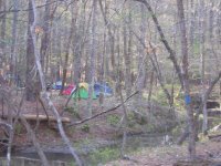 Thankfully this trail and the few primative campsites are on the opposite end of the park as the rest of the campsites, so you will not encounter any rv's, plumbing, or noisy neighbors. The site at Rock Dam is rated to take up to 30 tents, (very easily can) and has 3 rock firepits and one picnic bench.
  The trail out there meanders through the forest, following 2
  streams and crosses over several old fire roads. During the spring and summer months you can find small swamps and drainage ponds teeming with life within several feet of
 the trail.
Lake Olmstead Clean up
As a part of the 'rivers alive' event, we helped clean up Lake Olmstead and the downtown portion of the Augusta Canal. Thanks to everyone that came out and helped, we pulled over 100 full size garbage bags and misc. other items. Now the kids of the area have a safe clean waterway to go and admire and play 'with'. (sorry no swimming).
 That's Chuck on the far left with his back to the camera and on the far right is Rebecca and Margret from the Augusta Canal Interpretive Center. The backdrop is the freshly cleaned banks of Lake Olmstead.
 That's Chuck on the far left with his back to the camera and on the far right is Rebecca and Margret from the Augusta Canal Interpretive Center. The backdrop is the freshly cleaned banks of Lake Olmstead.
Subscribe to:
Comments (Atom)
